Browse
···
Log in / Register

 6
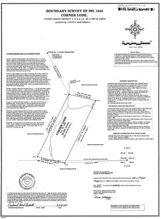
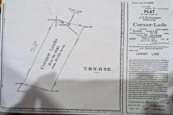
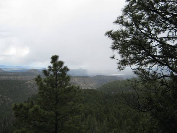
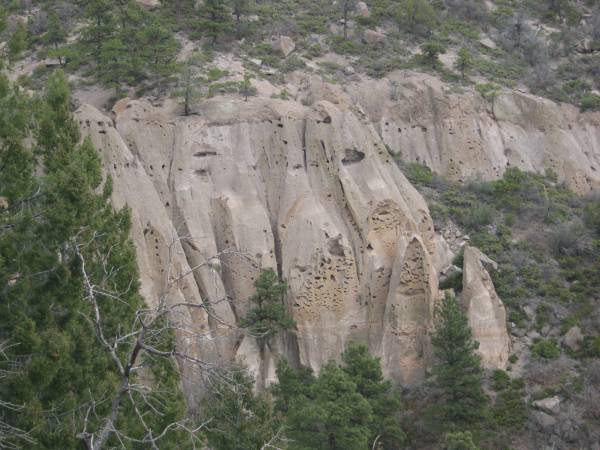
6Own a piece of history in the Bland canyon mining district; The Corner Lode This is a 20 acre, patented mining claim from 1897 in Santa Fe National Forest. The land in located on a finger mesa overlooking Colle canyon. A patented mining claim is a piece of land where the federal government has transferred its title to the claimant, giving them exclusive rights to the minerals and the land itself. There has been a moratorium on new patent applications since 1994. The Los Conchas fire and the resulting floods destroyed the road making vehicular access not possible. The land was also burned but many ponderosas survived and the scrub oak is coming in thick. Coordinates: 35.74356, -106.46496 Picture of original patent survey with tunnel locations (all collapsed) attached. The land was also professionally resurveyed in 2010 and recorded with Sandoval County. Clear title in hand. If you would like to see the land, I would suggest parking to the north at this location and walking south down the old Del Norte Canyon Road (FR268) 35.802076, -106.469889 This land was also part of the EPLUS land owner elk permit system in GMU 6C. I received several elk tags from 2010-2015. https://wildlife.dgf.nm.gov/hunting/maps/eplus/#mgmt-zone-map fivEzeRo56zeRo3zEro0seVen8